Topographical and Hydrological surveys
Topographical and Hydrological surveys
Essar Infratech offers topographical and hydrological survey services for civil engineering projects. These surveys provide essential information on terrain, surface water, and groundwater resources, helping engineers and planners make informed decisions and optimize project designs. Essar Infratech utilizes top-of-the-line equipment and skilled professionals to conduct accurate and reliable topographical and hydrological surveys.
- Key aspects of topographical and hydrological survey services provided by Essar Infratech include:
- Topographical Surveys:
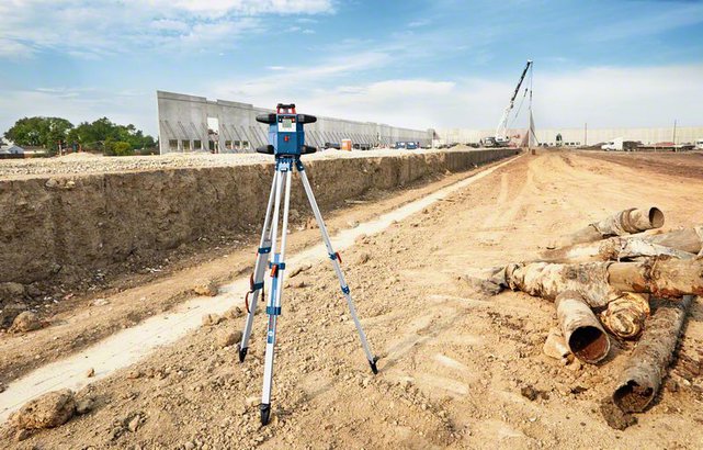
- Topographical surveys focus on mapping the earth's surface features, including natural and man-made elements, elevation, and contours. Essar Infratech uses advanced surveying equipment like Global Navigation Satellite System (GNSS) receivers, total stations, and digital levels to capture high-precision topographic data. We also employ advanced software like AutoCAD, Civil 3D, and GIS for processing and analysing the collected data, creating accurate topographic maps, and 3D models.
- Hydrological Surveys:
- Hydrological surveys involve the study of surface water and groundwater resources, including their distribution, movement, and quality. Essar Infratech conducts various hydrological studies, such as:
- Streamflow Measurements: Essar Infratech uses flow meters, current meters, and water level loggers to measure and monitor streamflow, helping engineers assess the availability and variability of surface water resources.
- Groundwater Monitoring: Essar Infratech installs and maintains groundwater monitoring wells, collects water samples, and measures water levels and quality to understand groundwater resources and their potential impacts on civil engineering projects.
- Flood Risk Assessment: Essar Infratech evaluates flood risks by analyzing historical flood data, regional rainfall patterns, and watershed characteristics. We use software like HEC-RAS, HEC-HMS, and SWMM for flood modeling and risk assessment, helping engineers design appropriate flood mitigation measures.
- Stormwater Management: Essar Infratech assesses stormwater runoff and designs effective stormwater management systems, such as detention ponds, swales, and infiltration trenches. We use software like HydroCAD and StormCAD to model stormwater systems and optimize designs based on performance, cost, and environmental considerations.
By employing top-of-the-line equipment, advanced software, and skilled professionals, Essar Infratech ensures that our topographical and hydrological surveys provide accurate and actionable information for civil engineering projects. Our commitment to quality, precision, and innovation helps clients make well-informed decisions and optimize project designs, ensuring the success and sustainability of various infrastructure developments.